
14th February2017
Well here we go again in a small way at least. At present I am on a JetStar flight to Hobart having been delivered for an early, 6am start, at Tullamarine.
The goal is a short walk of 42 kilometres over four days on the Tasman Peninsular. It is The Three Capes Walk which covers some beautiful territory down that way. I will bus from Hobart Airport to Port Arthur, takes about ninety minutes. Then check in at the Info Centre – this walk is heavily regulated as they only take about 40 people per day onto the track and it costs about $490 for the three-day experience. The camping provisions are a little up market in comparison to the Bib. Beds with mattresses in rooms and cooking facilities and guides at each of the three Huts explain the cost a bit.
So today I will get to Port Arthur and then take a boat across to the Peninsular. On Friday, at the end of the walk I will be picked up by a bus and brought back to Port Arthur. Then I will get a return trip back to the airport and fly home for a 11pm collect by Ruth at Tullamarine.
This is part of the preparation for the Bib walk in mid-May so I am walking with the guidance of my Exercise Physiologist building up for that time. My weekly walking program will eventually get up to 60 kilometres per week. At present I am around 40 kpw. This week will be the first of two walks: one on the Three Capes and the other out of Halls Gap in the Grampians over three days. Apart from the leg strengthening it will give a bit of pack carrying preparation as well. So here we go as the sun rises over Bass Straight.
Hobart in 30 minutes then it is off and running, well walking anyway.
After landing in Hobart I was picked up by Pennicott Travel who do the bus run between Hobart and Port Arthur. The bus was full of would be walkers. I worked out there are 45 new people on the track each day. Spread over the three huts it means there are 135 people on the track each day. Some 60,000 have used the Three Capes walk since it was opened over a year ago.
After rearranging my pack and having lunch at the Centre I turned up at the Wharf to join the other walkers. We were to be taken across the harbour to a beach on the eastern shore where the walk starts. But not before an hour-long wild water ride in a very fast boat. For that experience we donned a waterproof poncho for when the spray came over us. The wild ride took us around some of the rich views of cliffs and waters surrounding Port Arthur.
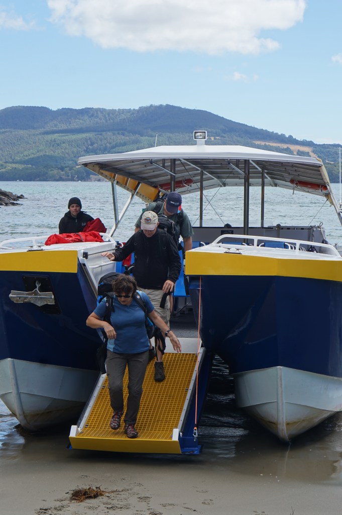
Eventually we exited the boat Marine style out the front on to a pretty little sandy bay and then began the walk.
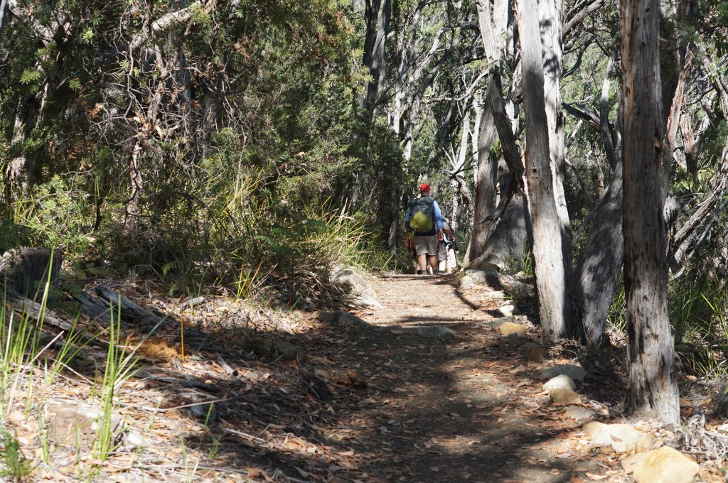
The first section drifted along the coast dipping in its contours and rising to reach the level we needed for the next three days. Through beautiful woodlands and great coastal views including pebble and sandy beaches overlooking Port Arthur. The preparation of the track has been incredible. Most materials were helicoptered in to create bridges, pathways and the magnificent residences.

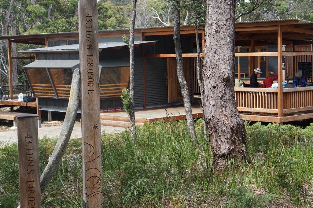
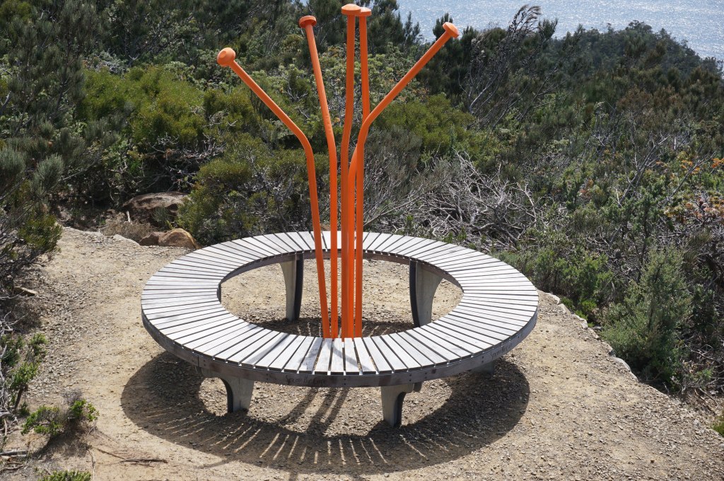
Finally arrived at Surveyors Hut, the camp for the first day. In each residence there are six accommodation suites of bunks complete with rubber mattresses, several fully equipped kitchens, a balcony sunning spaces for resting and laundry and enviro loos. No showers. It is luxury compared to the Bib huts but they service a different style of walker. People with money. Good to be back on a track with the turtle on the back wondering where the next step will come from at times, but it does.

Tomorrow we walk 14 ks away from the coast. The next hut will provide the springboard for Thursday when we edge up to some of Tassies southern coastal monoliths. Some of that will be using a day pack which is encouraging.
15th February 2017
Started the day early, about 6am, to get packed, breakfast, clean up and go. At 8.15am I was on the way behind a few of the racehorses who had made it off earlier but not as slow as others still enjoying their bunk.

The undulating territory took us along the west side of the peninsular and had us slowly climbing, with some difficulty. The track is known for its many steps and today we encountered them. All brilliantly laid out in local stone or in neatly sawn treated pine. The work of preparation has been incredible with a strong use of helicopters to drop materials off for the contractors.
We finally reached the peak at Point Arthur overlooking the stretches around and south of Port Arthur. There was a huge liner out from Port Arthur obviously ferrying customers in for the day to have a look at our tragic past.
The dolomite cliffs are spectacular with varying ruggedness define its own beauty against the backdrop of the ocean. Occasionally a little boat pops up but usually there are vast expanses rolling towards the cliffs throwing up white spume with regularity.
The walk was broken up with slow and steady climbs us sharp ascent and rolling curves. Then down the other side knowing that another climb would follow. The toes are battered on the downward climb, a bit of work for the podiatrist coming up.
Then the hills are over for a moment and we are on a meadow powering across the flatlands on the timber decking which protects the undergrowth. Then another pause as we look at one of the many information bays along the way.

The designers of the track have drawn in many of Tasmania’s creative people in all aspects of this presentation. The huts are a local design incorporating local ingenuity in design and the use of Tasmanian wood and features which frame the buildings with distinctiveness. The time we in the buildings is magnificently crafted and placed in a creative manner. Small pods create social spaces in a comfortable manner both in the dining areas and outside. People gather easily because of the setting.
Along the way we are asked to consider the history of Tasmania, the history of this part of Tasmania, its geology, its ecology, its wildlife. A wonderful handbook has been so well prepared and allows the walker to experience more than what they can just see.
I walked on over a small rise through a wooded area and encountered my first snake, a little black tiger about half a metre long. It wriggled across the track despite me and went on its way before I could photo the occasion.
Finally, I got to where the path divides into north and south, going south for another hour to the current campsite. This campsite is in the centre of the experience and tomorrow I first walk south, pack free, to view Tasman Island then I will retrace my steps, return to the campsite, pick up my pack and go north to the next campsite.
For the moment I am resting with the 40 others preparing at Munro Cabin for another interesting day tomorrow when we walk to the edge of the cliffs and view the ruggedness of the south of the Peninsular.
Most of my fellow travellers are seasoned walkers of one sort or another. All have their own ways of doing things little preparing meals, walking patterns and speed, knowledge and ignorance about where they are but a general love for what they are doing.
Have had many pleasant chats with people from around Australia including some who spent part of last week with Phillipa and Chris at Maria Island.
Fish and noodles for tea, laced with tomato paste, white wine, Parmesan cheese and a few herbs. A bit of dark chocolate and dried apples. Now for a drink of hot chocolate to end the day.
Oh yes. There is a shower here. We have a little red fire bucket which we put under a tap from which pours out hot water from a gas fired heater. A real joy to wash off the grime and put on fresh clothes. Found a mirror, had a shave. Nice, nice, nice.
So it is off to bed on my comfy mattress. Food is prepared for tomorrow, bags packed and ready to go. I enjoyed the long recovery time today and look forward to not having to carry the”Turtle” all day tomorrow.
16th February 2017

Hi there again. Well this was an eventful day with a long walk down to the end of the Tasman Peninsular until we got to a lookout overlooking Tasman Island with its lighthouse. The walk down was spectacular in itself taking just over two hours using only a day pack full of water and eats. The track is beautifully crafted with local rock for steps and treated pine ramps over the environment. These ramps stretch literally for miles at a time which must have been a significant construction feat. The fauna changes along the way from dense rain forestry stuff to a tundra like foliage and then bare open spaces. As you near the coast it breaks into shale or some rain forest again. You walk along the cliff face for a long period of time catching the occasional glimpse of the dolerite formations which stand tower like having been formed at some period in time and giving a monolithic appears of grandeur. We walked out along the Blade where you get the full impact looking back on the beautiful structure of the cliff faces with their long drop down to the blue ocean and similar coloured sky. Truly wonderful to behold. One also overlooks Tasman Island and the various structures supporting the lighthouse become clear including the residence for the workers. You can even hear the seals barking and see them dimly in the distance. The undulating nature of the environment meant that many steps were encountered again and the muscles surround the hip are tonight, quite tender.

It took 2-1/2 hours to walk down and the same time to walk back. Our backpacks were stored at Munro Cabins where we stayed last night. I walked alone for most of the time, having started the earliest it took a while to be overtaken by younger people on the way down but not on the way back.
A little exhausted and in need of nourishment I hoed into my three day old bacon topped bread bun and didn’t notice if it possessed mould. After a cuppa and a chat with the incomers to Munro for today and tomorrow I set off to retrace some of Tuesdays steps and then deviate on to Retakunna Cabins for tonight. Thankfully after five hours on the trip to The Blade it was only an hour to the next hut. Arriving early gave opportunity to unpack and tidy up before having a nap. Had tea with a couple from Queensland who have been bushwalkers for 40 years and they cooked out of a handle less aluminium pot they always take with them. It was great to share experiences and to hear of their doings over that time. Tomorrow we climb a significant hill in front of us and press on to the coast to see some more columns and coastline. Then on to Fortescue Bay where we will be picked up by bus and in my case taken back to Hobart Airport for a late flight to Melbourne.
The trip is achieving its purpose of toughening me up for a return to the Bib in April. The magnificent organisation behind the walk has made it even more significant and left me with great memories of wonderful country and people who manage this part of the world.
17th February 2017
A good night of sleep was followed by an early rising for everybody.
Today there would be two pick ups by the Bus at Fortescue Bay – one at 2pm and one at 4pm. After leaving early and with solid walking I got to my meeting at 3.40pm which indicates something of the tough day it was.
With breakfast done and lunch prepared I was off at 7.30pm. No match for the early younger bolsters or the well conditioned geriatrics however I was able to keep a reasonable pace.
Our first task was to ascend the 480 metre Mt Fortescue. Again, the track had been immaculately prepared with good steps made of stone or wood with close attention to gradient allowing longer walks instead of a step up. The Mount is in a strong rain belt and so is host to a prolific rain forest. The guiding information provided through our booklet helped in interpreting the experience.
The climb seems never ending but it does with a glimpse back over the Tasman Peninsula where we were yesterday and forward to the home of the Candle Stick and Totem Pole on Cape Huay. These monoliths have been rightly compared to the Giants Causeway in Northern Ireland, although they go up rather than along.
Descending became a bit difficult as the constant need to watch you footing reduced the appreciation of the topography and foliage. The further one went the more frustrating it became it the track refused to release you to daylight insisting on the up and downs of the land mass been matched by the stepping- stone progress of the pathway.
At last the bush changed and the rainforest was behind us just in time to meet the intersection of pathways where we were to leave our bags. Then began another series of dramatic ups and downs. An hour each way to catch a glimpse of the rock monoliths. And we were pleased to notice that there was someone at the bottom on the Candle Stick about to ascend up their ropes. But our bus would be there at 4pm so waiting around was not possible.
Returning over the roller coaster hills, I eventually made it back to the junction where I picked up my pack and began my hour of descent off the plateau and down to Fortescue Beach bus stop. A little arduous at first but then energy came to all but the feet. I was cheered in by my new friends at the Cafe and this was followed by a treat, a tongue reducing Icy Pole and a Diet Coke.
We all jammed into the little bus with our bags and tootled back to Port Arthur. The bus continued to the Airport dropping off a few of us and taking the rest into Hobart.
I rearranged my belongings and changed into less pongy clothes.
I am now in the air on the flight back to Melbourne.
The creation of the Three Capes walk has provided a uniquely structured experience for competent walkers. The infrastructure: track, accommodation and links to Tasmanian cultural heritage. A wonderful time exploring this piece of Australia. You can cover the same territory by sea with a Pennicott day boat trip around the area. I learnt so much from the experience and from the wisdom of my fellow walkers. Let’s see if it helps.
