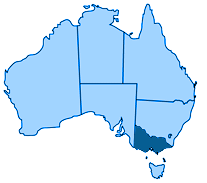
South West Victoria, Australia
Tuesday 14th March to Thursday 16th March.
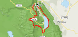
Three day / two night circuit walk
Distance: 36.6km total
Day1 : 8.6km
Day 2 : 13.8km
Day 3 : 14.2km
Time: 3 days / 2 nights
Start/Finish: Halls Gap
Grade: 4 (very steep, formed track, many obstacles, clearly signposted)
Experience required
Bushwalking experience recommended – well-prepared and self sufficient bushwalkers prepared for all weather conditions.
Elevation changes
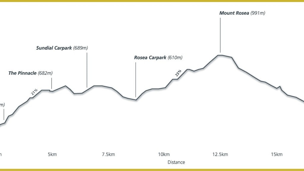
- Day 1: 840m
- Day 2: 1033m
- Day 3: 600m
Camps
Datum used GDA94 Zone 54
- Bugiga Hiker Camp GR339840
- Stoney Creek Group Camping Area (for school or large groups) GR318841
- Borough Huts Campground GR366791
Topographic map required
Scale: 1:50,000 recommended
Day1 : 8.6km
Day 2 : 13.8km
Day 3 : 14.2km
Time: 3 days / 2 nights
Start/Finish: Halls Gap
Grade: 4 (very steep, formed track, many obstacles, clearly signposted)
Experience required
Bushwalking experience recommended – well-prepared and self sufficient bushwalkers prepared for all weather conditions.
Elevation changes
- Day 1: 840m
- Day 2: 1033m
- Day 3: 600m
Camps
Datum used GDA94 Zone 54
- Bugiga Hiker Camp GR339840
- Stoney Creek Group Camping Area (for school or large groups) GR318841
- Borough Huts Campground GR366791
Topographic map required
Scale: 1:50,000 recommended (Prior information from: Visit Grampians.)
Tuesday 14th March 2017.
As part of the training for returning to the Bibbulmun Track in April I planned two shorter walks. One of those was the three Capes walk in March a 46-kilometre walk on the Tasman Peninsular in Tasmania. This was accomplished in three days. The second walk, which I completed this week, is called The Grampians Peaks Trail. The Grampians Peaks Trail is being devised to run along the whole of the Grampians and is under construction now. The first section is now complete and offers a 36-kilometer, 3 day/2 night circuit walk departing from Halls Gap and retuning to Halls Gap.
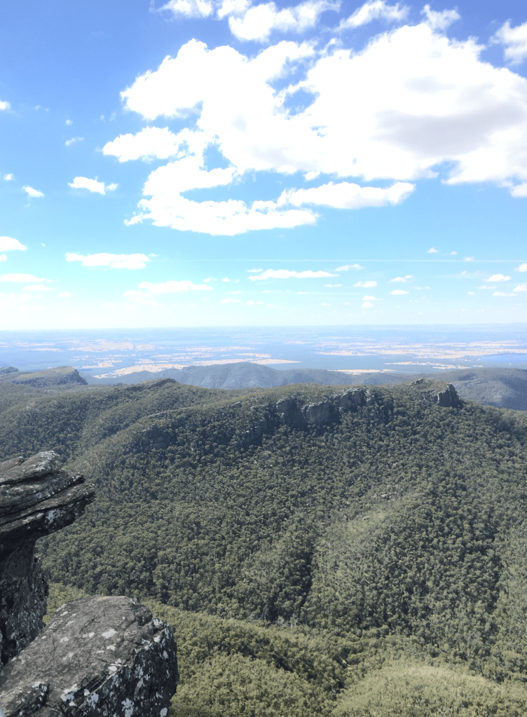
The publicity says: Be inspired by the spectacular outlook of rugged mountain peaks from the top of Mount Rosea, panoramic views from the Pinnacle Lookout, ancient rock features of the Grand Canyon and the rich cultural history of this truly iconic Grampians landscape. (Visit Grampians.)
Ruth and I drove down on Tuesday. After checking in at Brambuk information centre I and made a start at Halls Gap late in the afternoon. Walking up the gullies was hard work through the Venus Baths ponds on onward through a well-constructed pathway and many, many steps. up through the ascending hill towards the first of the peaks at 682 metres.
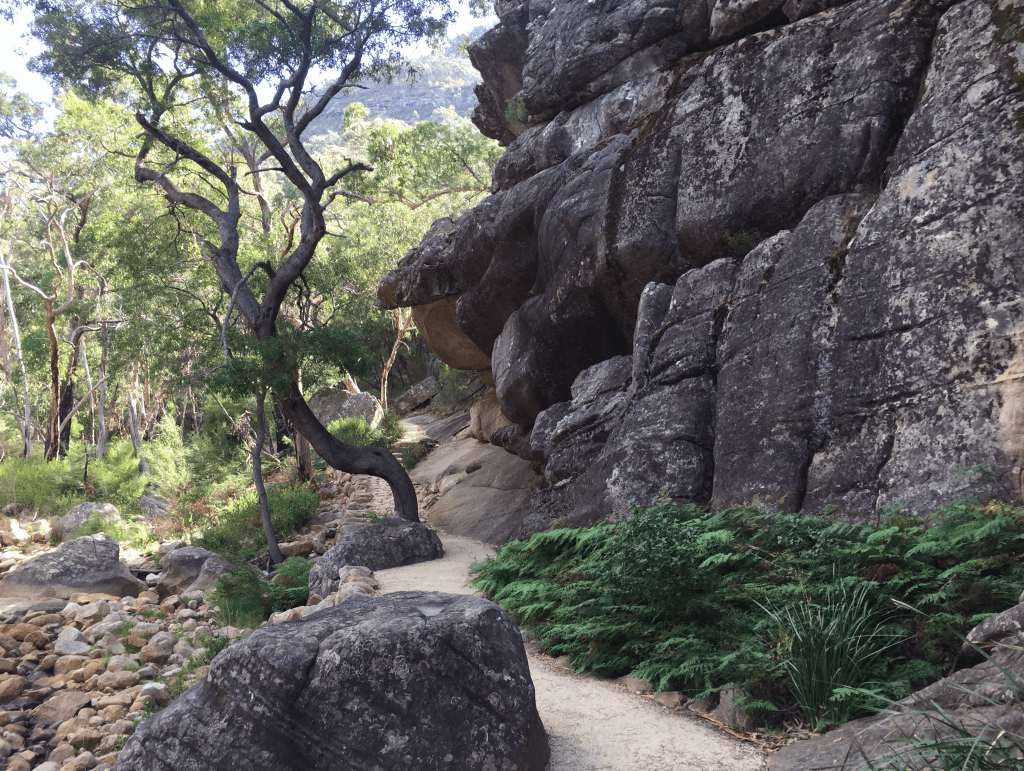
Got to the Wonderland Car Park and then started to climb up to the Pinnacles. I took a wrong turn and instead of ascending I descended deeply and went down through what is called “The Grand Canyon” which was a significant descent through an iconic rock form of the Grampians. But it brought me back to the Wonderland Car Park, which I had left some time before. As it was now getting late I did not finish the rest of the section by foot but Ruth drove me up to the Rosea Car Park where we had intended to meet for a water drop. I then walked in to the Bugiga Campsite where I stayed the night. Ruth went back to her motel at Halls Gap.
The Bugiga camp is especially set up for Peaks walkers. It has toilets and a curved shelter for meals and meeting.
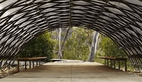
The 11 campsites are wooden platforms set above the environment, which can take a two-person tent. They have anchor points and a storage cage.
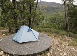
They overlook Mt Rosea which is the mid day goal for the next day. Adam and Molly were travelling alone and used the other accommodation platforms that night.
An early night followed a stroganoff, which I had frozen and brought along. Cleaned up and caught some sleep during the night, millimetres above the hard deck on my air filled blow up mattress.
Wednesday 15th March 2017
Up and away the following day. The brochure said it would take 5 hours to get to the next campsite. I left at 9am reached my destination at 6pm. The first goal was the ascent of Mount Rosea (1000 metres) Initially it was relatively easy on a well-worn flat path. Then the rocks started. You go over them; you go under them, through cracks, up natural and created steps, over boulders and rock faces following the little yellow arrows. Concentration was demanding and at one point I did a quickstep with a little juvenile snake that was as surprised as I that we were so close. At 12n I looked over the edge of what I thought was Mt Rosea. Some descenders told me that I had an hour to go to the real summit. Thankfully it took a little less and I then spent some time cooling down, resting, nourishing getting ready for an ascent that would be as difficult as the coming up.
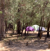
Finally I was off the mountain and on a long winding downward path to the next campsite. The final five kilometres doesn’t sound far but the full 20k pack and the rapidly emptying water bottles made me wonder if I would ever make it. But I did and was met by Adam and Molly and others from Kaniva Secondary College who had also walked that trail on the same day. They were most helpful in getting my tent set up. Ruth joined me, at the Borough Huts Campground is the second sleeping site for Trail walkers and is accessible by car. It was full of fellow trail walkers and organised outdoor adventures. Camping was a bit diverse some on the dirt others on specified patches of white grit. Ruth and I rattled up one of the fire pits and cooked our steak and onions and shared until it got dark and off she went to her motel, I was tempted to join her!
Sleep came more easily that night but my legs bear the marks of mossies. It rained a little before dawn but not enough to cause distress. I rose and had my porridge and fruit and then prepared for the final leg back to Halls Gap.
Thursday 16th March 2017
Ruth came out again and took most of my pack to make the final leg a bit easier. Left me with water, food and emergency stuff in my back pack. About 12 ks to go past a beautiful lake then following a fire trail along the side of one of the mountains. I moved a bit faster, in the flatter parts but languished a little on the rises, and there were many of those. The scenery was very pretty and the occasional view of the water and the mountains added a little to the pleasure. It took about 4 hours to do the 12 ks, which reflected my capacity in that type of country. After I Checked In at the Information Centre (safety requirement) we topped up with lunch and coffee at the Information Centre Café.
It certainly wasn’t an easy walk, particularly over the mountains. My legs are quite sore today, which is probably a good sign that the walking plan had a good effect.
It took us about three and half hours to drive back to Melbourne. A quick clean up then off to the Commissioning of a Anglican Minister at Mordialloc.
